
Do you have any old photos of the islands, marshes or piers?
Medway Council is in the process of creating a River Strategy which, once completed, will be instrumental in helping to address river user needs, monitor pollution, coastal erosion and secure future funding to protect and enhance river access locations and plan ecological improvements such as salt marsh preservation and creation. To help us understand the changing nature of the estuary and visual history of the river, we are seeking old photos of the following:
- St Mary’s Island
- Darnet Island
- Hoo Salt Marsh
- St Mary’s Island
- Oakham Marsh
- Burntwick Island
- Greenborough Marsh
- Rochester Pier
- Sun Pier
- Gillingham Pier
If you have any photos of these sites we would be very grateful if you could scan and send them to adam.taylor@medway.gov.uk or alternatively photos can be collected from your address, copies made and then returned to you.
This is a unique opportunity for river users to make the first contributions to the River Strategy. For any photos we use we will credit the person who provided them.

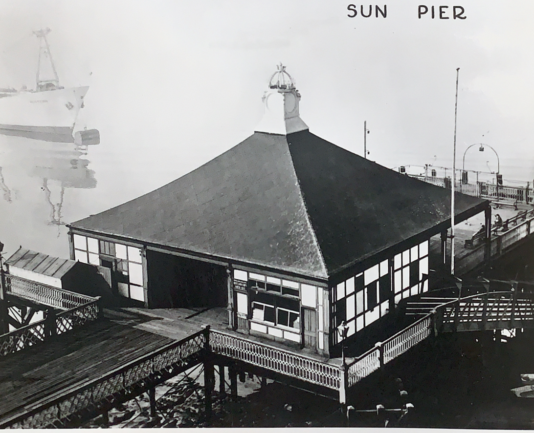
In the meantime, here are two photos: the farmhouse which once stood on Nor Marsh, taken in 1932, and Sun Pier taken in the 1960s, which we hope are of interest to MSBA members.
We look forward to hearing you. Merry Christmas and Happy New Year to you all.
Adam Taylor, Rivers & Paths Manager


I remember when I lived on the caravan site at hoo I was 10 60 years ago, the small island that was across from the wharfe had the river in between and when the tide rose it rushed through the gap and there was no mud and when the tide went out it rushed through again, they linked up the island and the creek silted up, experts ha ha